Viewing digital well logs within a web page is now part of the Analytics Addon, as is the ability to integrate these data within a 3D GIS scene. Based on the roughly 46,000 digital well logs obtained for over 5,000 wells (most wells drilled since 2004), a “golden set” of standard log curves for each well was derived out of the nearly half million curves from these logs. There are three grouped displays: geology & geophysical logs, mud logs and mechanical logs. Further context has been added to the last track, displaying paleo observations, geomarkers, hydrocarbon bearing zones and completion intervals gathered and integrated from GOM3.
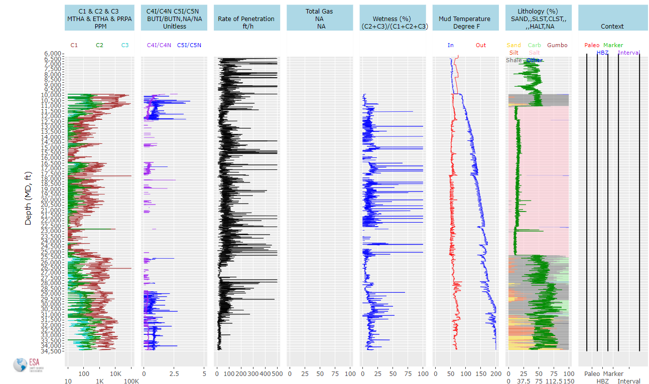
The mud log of the No. 2 BP1 well in KC292.
The tracks are dynamic, with the ability to zoom and pan and values of each curve are available when moving the cursor over the curves. Jumping to paleo or completion reports are available when clicking those features in the context part of the display.
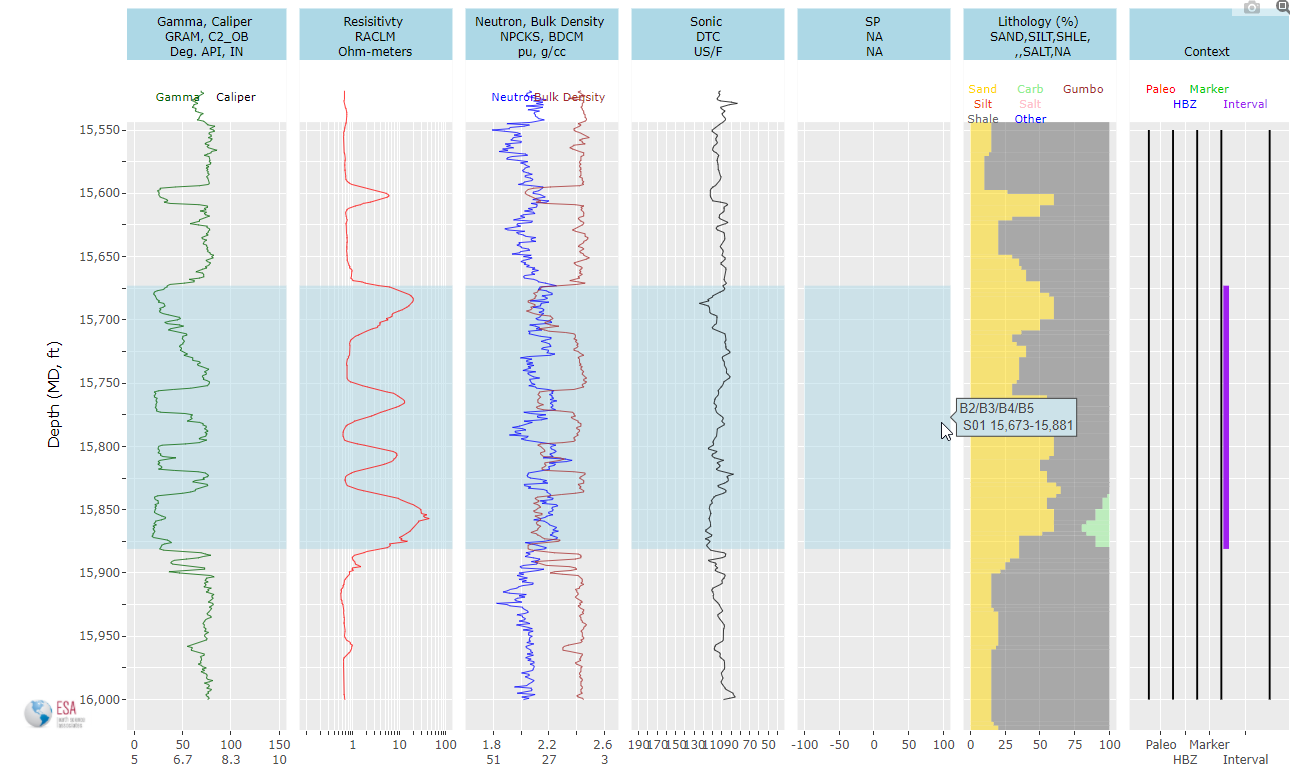
The G&G log of the SS1 well in MC257, zoomed in on the S01 completion interval.
The other major innovation is the integration of these data within the 3D scenes of GOM3. Each of the major curves can be displayed in 25-foot increments, providing important correlations between wells, for example high resistivities, low gammas or spikes in C1. Clicking on the curve values provides a jump back to the online viewer or other well data (reports, production graphs, downloads, etc.). Combining the well logs with the context of other data in 3D dimensions increases the power of the sharper visualization that ArcGIS Pro provides.
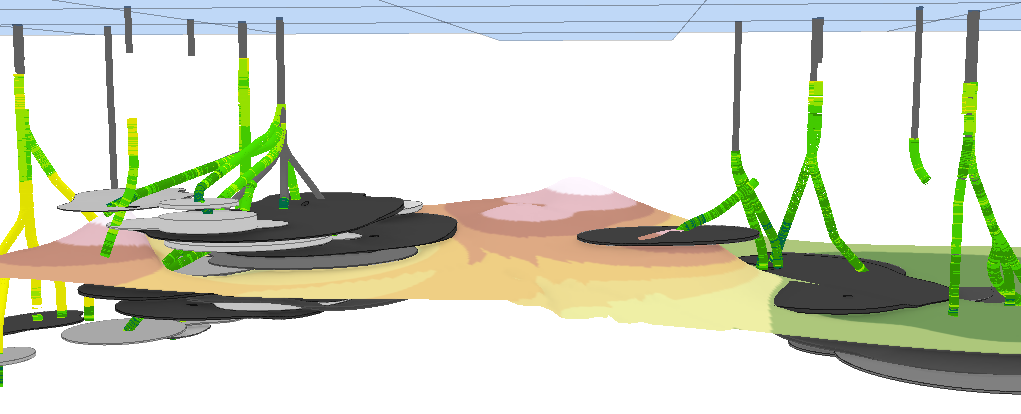
Gamma ray values along boreholes in Mars/Ursa with an interpolated surface of the Catinaster mexicanus horizon.
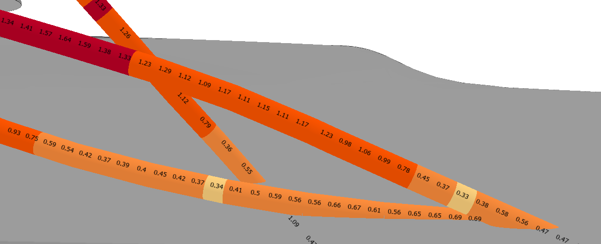
Resistivity values labeled along boreholes in the N_O sand of Mars/Ursa.