

Petrophysical Solutions, Inc. (PSI) well log data has been integrated into the GOM3 system under 3rd Party Data. PSI provides detailed well log interpretations in their 1500+ well Deepwater Gulf of Mexico database. This database includes water saturation, total/effective porosity, shale volume and other geophysical characteristics. PSI petrophysicists also offer “single-well analysis, field studies, seismic petrophysics, interpretations of large petrophysical databases and old log sets, as well as other geophysical consulting capabilities.” www.petrophysicalsolutions.com
PSI's well log locations can be accessed in our toolbar under GOM-Cubed-->Map Layers-->3rd Party Data. The PSI wells can be loaded by protraction area and/or log curve.
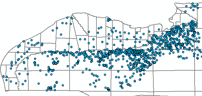
The specific PDF or LAS file can be accessed by using the hotlink tool (the red lightning bolt) to click on a point in the map.
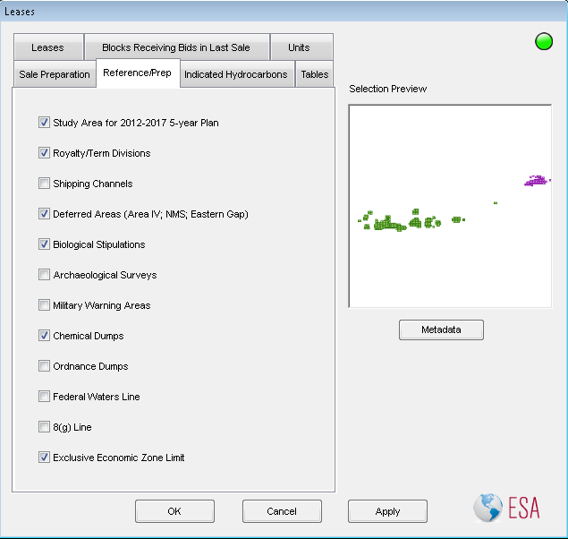
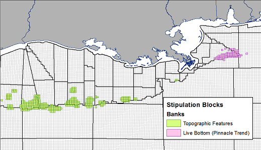
The Leases dialog has been rearranged to take advantage of a few new features. First, aliquot polygons now include the first five owners for labeling. As a consequence, it is now possible to load aliquot boundaries by company. This is done in the first panel of the window when loading leases. Second, many datasets that were (and still are) included in other dialogs are now in the Reference/Prep tab of the Leases dialog. The purpose is to make this window a sort of 'one-stop-shop' for all of the data related to a lease sale. As such, the deferred blocks layer has been moved to this tab, as has a new layer: Biological Stipulation Blocks. The other layers include the Study Area for the 2012-2017 plan, Royalty/Term divisions, Shipping channels (fairways), Archaelogical Surveys, Military Warning areas, Chemical Dumps, Ordnance Dumps and the boundaries for federal waters, the exclusive economic zone and the 8g line.
For a list of past newsletters, click here.