

Meet our new GOMsmart 2.0 - available in your computer browser and now accessible on mobile devices! After extended testing and user input, the GOMsmart 2.0 design is more intuitive and has many new features. It supports quicker and easier access to more data, additional analysis and can be brought to meetings or checked from remote locations by a few taps on a smartphone or tablet (Android, Apple and Windows). As before, data in GOMsmart 2.0 is updated by ESA hourly as new information becomes available. This includes a new, innovative and experimental real-time analysis of storms entering the Gulf of Mexico.
If you access GOMsmart by ESA's GOM3 desktop icon on your computer - just click it and choose GOMsmart - you will automatically go to GOMsmart 2.0. If you don't use our desktop icon on your computer, or to access GOMsmart 2.0 from mobile devices, go to www.gomsmart.com and click the Login button at the top of the page. Your email address is the username. If you don't know your password, click the 'Forgot Password' link to have it sent to you.
We outline a number of new features below and will provide more details over the next 6 weeks leading up to our 10th Annual User Conference on November 5th. If you still wish to use the old version of GOMsmart after experiencing GOMsmart 2.0 and the convenience of mobile access, you may still do so by clicking on the 'Return to GOMsmart Classic' link on the Welcome page after logging in.
Layout
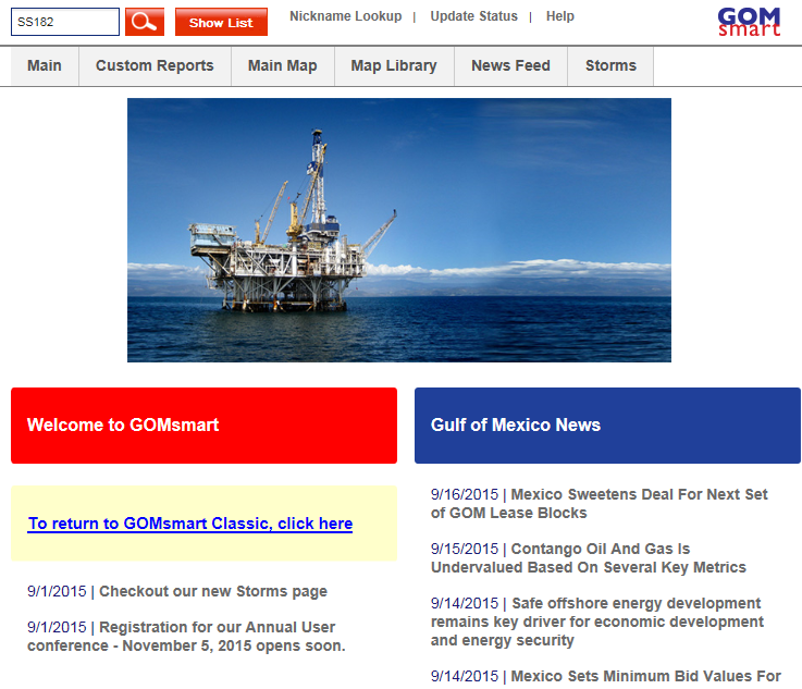
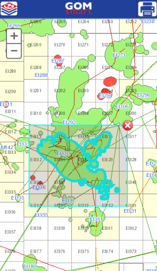
All of the categories of GOMsmart are now available at the top of each page: Main, Custom Reports, the Main Map, Map Library, News Feed and Storms. Entering a block in the upper left navigates the main page to display data specific to the block:
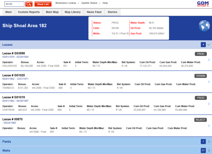
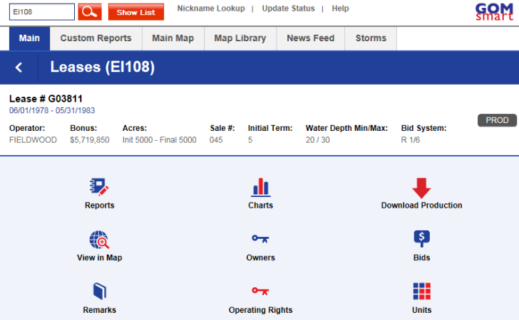
From there, clicking on a particular Lease, Field, Well, etc. drills down to explore more information. Never before have details like Ownership, Well Logs or Decline Curve Analysis been so accessible at your fingertips.
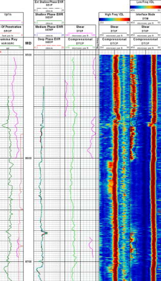
Exmaples from a smart phone: Viewing the EI330 field in a map and previewing a well log from the PI2 well in MC765.
Report and Charts
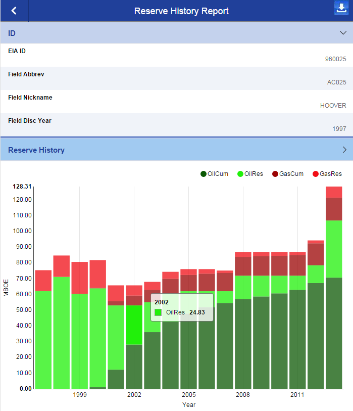
Reports and Charts have been rebuilt for dynamic interaction and scaling on browsers and mobile devices. The initial displays are designed for performance within a web page, but both sets can be downloaded as PDFs (or PNG images for charts in Internet Explorer). This is the Reserve History report for the Hoover field (the annual numbers are collapsed but expandable):
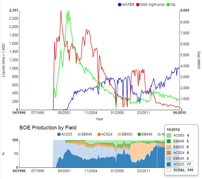
And here is an example of the production graph for the Hoover Spar in AC025:
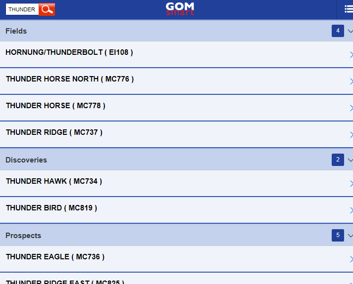
Search
As mentioned before, the text box in the upper left can be used to navigate by entering a block number. But it can also allows searches of any identifier among the datasets: API Numbers, Pipeline Segments, etc. For instance, these are some of the results when searching for the word 'Thunder':
Other items along the top of GOMsmart can be used for locating information as well. The Nickname Lookup lists all of the Field, Discovery and Prospect nicknames in the database. The Update Status page displays the vintage of each dataset and the newly improved help covers all of the pages and data of GOMsmart and includes its own search capability.
Clearly this is only a portion of the new GOMsmart. The News Feed is taking in stories from a number of industry-specific websites to display news pertinent to the Gulf of Mexico. The Storms map displays data from not only the National Hurricane Center but forecasts generated by Earth Science Associates even before storms form. More information will be coming in subsequent newsletters.
Thank you to all who gave us feedback on the new design during development. As always, we're already planning new enhancements, so please contact us for suggestions, questions or other comments: contactesa@earthsci.com
10th Annual User Conference
Registration for the 10th Annual User Conference is now open! It will be held November 5th in The Woodlands. The conference is intended for geologists, geophysicists, engineers, land specialists, GIS professionals/techs, and managers. The exchange of ideas and directions for our future development are still the top priority of the conference; we will continue to aim for the informality and small size of past years. Registration is free, though limited, but we will do our best to accomodate all who wish to attend.
To attend the conference, please click here to register.