


This month marks the introduction of the beta version of Global Loader into GOM3. The Global Loader is a new interface to load and manage GIS data and projects. It includes GOM3 data but is specifically designed to allow you to manage all other GIS data at your company.
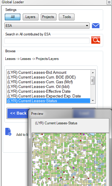
The main section displays a wizard to drill down through categories (using GOM3 or company-created categories) to the layer to add to the map or the project to launch. As shown to the right, this example displays Lease layers from ESA, with a preview image while moving the mouse over the list.
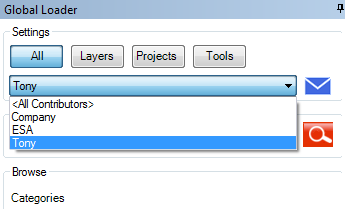
Data from your network can be added to the list. Once added, it is easy to filter the data at the top of the window by type (Layers, Projects, etc.) and by contributor, such as yourself, ESA or Company (all non-ESA data).
Projects/maps are displayed in the same window; these include ArcMap documents (MXD), ArcScene documents (SXD), ArcGlobe documents (3DD) and ArcGIS Pro projects (APRX). At the moment, Add-Ins are included to load layers into ArcMap and ArcScene, though projects can be added for ArcGlobe and ArcGIS Pro as well.
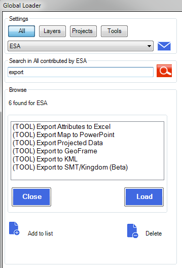
Because the amount of data listed in Global Loader can become very large, it is possible to search layer/project names, categories and tools at the top of the window. The example to the left displays the results when searching for the word 'export'. Searches can also be limited to a particular contributor.
We will hold webinars about the Global Loader in the upcoming weeks. The first two will be for the power users, technicians and GIS administrators who will generally load and manage the way each company takes advantage of the Global Loader. These two webinars will take place on March 24th and March 31st and should only be about 30 minutes. Registration is available here. Smaller overviews are available if you cannot attend these; contact Tony Dupont for more information.
Webinars for everyone else on using and adding data to Global Loader will be available early next month. We will send out more information once those dates are set. If you have questions or feedback at any time, please let us know.
ArcGIS Versions
A quick note on supported versions of ArcGIS Desktop: This is the last month for support of ArcGIS 10.0. Hopefully everyone is using ArcGIS 10.1 or higher by this time.
We are just beginning the primary testing for ArcGIS 10.4. We do anticipate some structural changes that will need to be addressed so please don't upgrade to version 10.4 yet except for testing purposes.