

The 11th Annual User Conference will be held on Thursday, October 27, 2016 at Statoil's offices in west Houston (Register here). As always this event will present details about improvements from the past year and a look at future plans, including a forum for suggestions on that future.

The conference is intended for geologists, geophysicists, engineers, land specialists, GIS professionals/techs, and managers. The exchange of ideas and directions for our future development are still the top priority of the conference; we will continue to aim for the informality and small size of past years. Registration is free, though limited, but we will do our best to accommodate all who wish to attend.
Agenda
To attend the conference, please click here to register. We look forward to seeing you there.
GOMsmart Mapping Developments
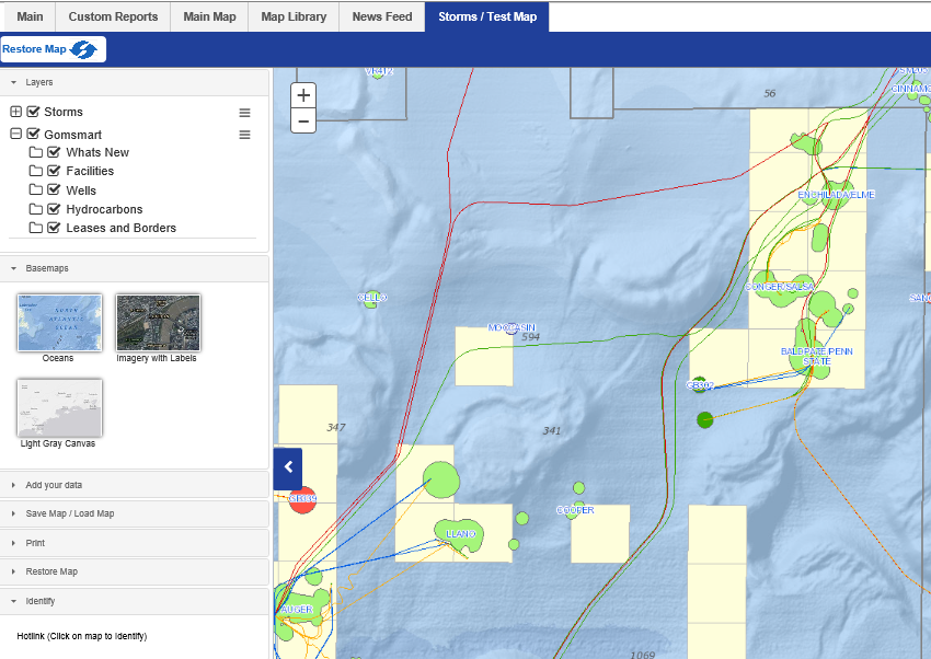
The Storms Map tab/category in GOMsmart has been modified to debut some of the new technology currently being developed. This map has a new design to make more customization and data available.
First, all of the GOMsmart data from the main map is available here to fully integrate with ESA's storm forecast and hurricane tracking. Basemaps to show the seafloor, satellite/flown imagery and a light gray background are available as choices to fill out the map.
ArcGIS map services (from your company or other publicly available sources) can be added directly into this GOMsmart map. Comma-delimited files containing point coordinates can be loaded on to the map as well.
This map can be saved so that it can be loaded again later (with other map services linked in) or shared with others. It's especially useful when setting up a map with many different services or a specific location that needs to be highlighted.
This is the first of many expected additions to the mapping capabilities of GOMsmart. Please let us know your thoughts by contacting us at contactesa@earthsci.com.