GOMsmart has a new utility to generate block-level plat maps and ease the creation of permit applications to BOEM/BSEE. The new Plat Map section of GOMsmart allows for the entry of a well name and suffix, along with the surface location, bottom hole location and depths. It also includes other optional layers (leases, wells, platforms, pipelines and field outlines), to display as desired. As shown below, black-and-white or color maps are available, all projected to the correct coordinate system for that area.
Along with this change, the previous Custom Map has now become the Main Map (and only dynamic map). This map has many additional qualities over the previous map, including the ability to modify the base map, add other web services into the map and share the dynamic map with others once it has been customized. This was also an important change as some current browsers, such as Chrome, no longer supported the contents panel of the old map.
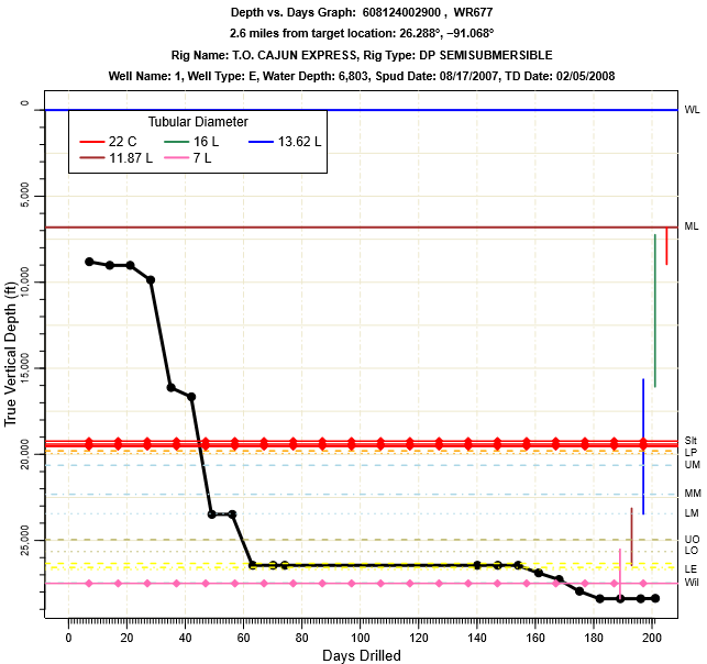
For subscribers of the Business Planning Add-on, there is a new name: the Analytics Add-on. There are a few new features in development right now that will continue to add more analytics and visualizations into this Add-on. While the Add-on will contain even more beneficial data for planning, some of the new features focus on project development, such as gathering data for nearby wells to display drilling times, casing and stratigraphic penetrations, as shown here. More information on new analyses coming soon.

Depth v. Days Drilled graph in the WR677 No. 1 well.