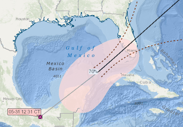
As we often do at this time of the year, we wanted to remind everyone about Storm Forecasts in GOMsmart. As of the writing of this newsletter, the remnants of Hurricane Agatha are crossing Mexico and forecast to potentially form a new storm at the southeastern edge of the Gulf. The likely formation area does not threaten production in the northern Gulf, but it does illustrate the forecasted track, shown below, long before the National Hurricane Center. This forecast uses historical tracks, the NHC's region where a storm is likely to form, and the current location to calculate a likely path if the storm does form. More details are available in GOMsmart's help page on the subject and information about wind speed predictions at a platform is in last year's newsletter about storms.

Potential storm track as of 12:31 CDT on May 31st.