

Earlier this year the GOM3 Geophysical Addon added several tools to take 3D SEG-Y files, convert them into GIS data and publish them into ArcGIS Online or Enterprise. With the latest upgrade to GOM3 Geophysical, this process has been streamlined to combine tools where possible and get your proprietary 3D seismic data into a browser as quickly as possible. And yes, that includes creating the web page to display your seismic data, with or without GOM3 data (though it is probably more helpful with the context of GOM3 data such as wells and sands). Overall, the steps of this process should make viewing seismic data vastly quicker in ArcGIS and make it possible to show, interactively in a web browser(!), to everyone that needs to see it. This example of the Mahogany field is a good example of what can be done with your seismic data.
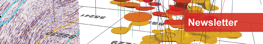
 The new interface to convert SEG-Y to GIS format, publish and create a web application.
The interface now contains five buttons to get data from SEG-Y to an interactive web application. The first simply reads the header from the SEG-Y file to a text file so that it can be used for other input (or simply to access survey information without loading it into a large seismic application). The second button converts all SEG-Y files into GIS files to load into a 3D scene, taking input such as the coordinate system and navigation units (hopefully in the SEG-Y header or other files/PDFs). At this point, it's possible to work with the seismic data in ArcGIS.
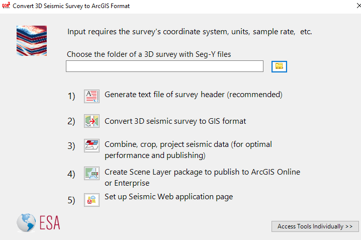
 Mad Dog sands in front of a seismic survey. The 3D data is fully interactive and customizable.
The third button preps the seismic data to be shown online. The area can be cropped for performance, combined with other files within the survey and then projected for proper display in a web browser. The fourth button launches the ArcGIS scene layer package creation to publish in ArCGIS Online or Enterprise. Finally, the last button creates a web page that can be placed on your website or distributed as you see fit to share with others. It includes an option to set credentials for ArcGIS Online or Enterprise.
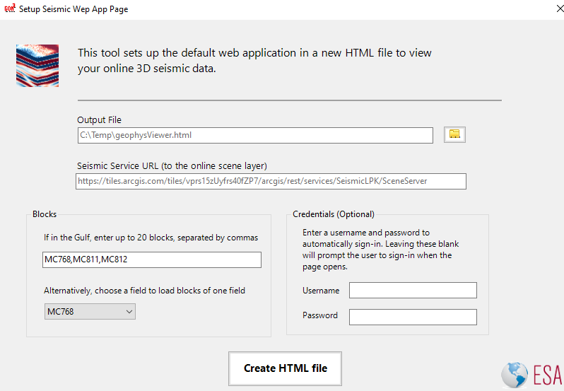 The web application creation form.
All of the individual tools are available in this interface as well. We urge you to schedule a demo to see how the Geophysical Addon can save you time exploring and analyzing your seismic data. Contact Tony Dupont today for more information.

Support for ArcMap (and ArcScene and ArcCatalog) is ending soon. Esri has ended all updates and patches for ArcMap and will end final support in March 2026. However, GOM3 support for ArcMap will end in December as increased ArcGIS Online services will improve updates for ArcGIS Pro. If you have questions about the end of ArcMap support or would like to learn more about ArcGIS Online served GOM3 data, contact Tony Dupont.